
WSO Menu
Promoting the enjoyment, study, and conservation of Wisconsin's birds.

Online Haunts
This is an online version of Wisconsin's Favorite Bird Haunts - a guide to 1000+ of Wisconsin's most favored locations for birding, with maps. Select the links below to view each chapter with newly created Google Maps to navigate to and explain the locations described in each article.
Note: The 5th edition of this book (current as of the last year of publication - 2009) is available as downloadable PDF documents for each region. The WSO is working on updating the content of the online guide provided here.
Introduction and Artist Credits
This section contains the original introduction, list of Wisconsin bird habitats and the artist credits for all the illustrations used.
... Read MoreMississippi River Valley and Western Wisconsin
This section consists of the Mississipi River Valley and Western Wisconsin. The areas covered are highlighted in the map below with the numbers corresponding to articles in the table of contents below and include parts of Grant, Crawford, Vernon, La Crosse, Trempealeau, Buffalo, St. Croix, Polk and Burnett Counties.
... Read MoreNorthern Wisconsin
This section consists of Northern Wisconsin. The areas covered are highlighted in the map below with the numbers corresponding to articles in the table of contents below and include parts of Douglas, Bayfield, Ashland, Iron, Vilas, Forest, Florence, Marinette, Oconto, Langlade, Oneida, Price, Sawyer, Washburn, Barron, Rusk, Taylor, and Menominee Counties.
... Read MoreCentral Wisconsin
Southern Wisconsin
This section consists of Southern Wisconsin. The areas covered are highlighted in the map below with the numbers corresponding to articles in the table of contents below and include parts of Iowa, Dane, Jefferson, Waukesha, Walworth, Rock, Green and Lafayette Counties.
... Read MoreLake Michigan

This section consists of the Lake Michigan Area. The areas covered are highlighted in the map below with the numbers corresponding to articles in the table of contents below and include parts of Kenosha, Racine, Milwaukee, Ozaukee, Washington, Sheboygan, Manitowoc, Kewaunee, Door, Brown, Oconto and Marinette Counties.
... Read More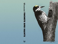
State-wide map based index to bird haunts and direct links to highlights.
... Read More